

Hurricane Ian exposed Florida as a hotbed for 'climate gentrification' – research may have an answer
- Jon Shieber
- Oct 10, 2022
- 6 min read
“Why don’t you just move?”
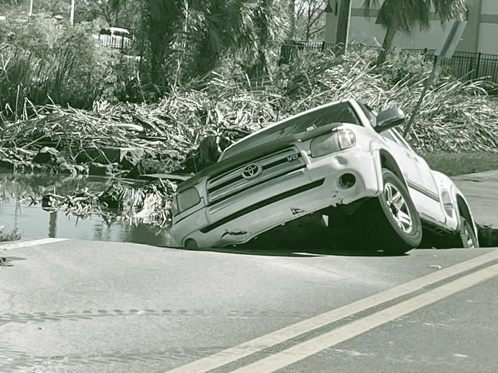
The question comes up every time a natural disaster ravages a region. The latest in America, Hurricane Ian, was just shy of Category 5 status when it made landfall in southwestern Florida on Wednesday, September 28. What started out as barely a Category 1 strengthened to the fifth strongest hurricane ever to make landfall in the U.S. in just 48 short hours.
Natural disasters like this are creating more and more climate refugees and prompting people to preemptively move to safer regions.
In 2018, the U.S. federal government’s National Climate Assessment warned that nearly 13 million people across the country would need to move by the end of the century due to sea level rise alone.
Not only does a growing body of evidence suggest that the country isn’t equipped to handle mass climate migration, but research is also showing that regions like Florida are becoming more and more prone to what’s known as climate gentrification.
Dixie Farms, a neighborhood in Tampa is one community impacted by climate gentrification -- and its troubles may only be beginning, according to a study published two days after Hurricane Ian hit Florida.
An area that was once full of mobile homes is now dotted with patches of empty land. According to residents via NBCLX, the land, once a mobile home park, was sold and cleared out because their properties are in high demand. The reason? It’s because these areas are safe from sea-level rise, as researchers from Columbia University and Tulane observed in an April report.
Now, the same researchers have released a new study showing the correlation between climate gentrification and the aftermath of events like the fatal Hurricane Ian.
Climate gentrification is a a new name for age-old intersecting forces of consumer and investor demands. In this case, it's the rising need for new housing and protection from the risks of climate change.
For lower-income and immigrant households and renters, climate gentrification basically means relocation to accommodate richer residents answering the question “Why don’t you just move?” by flocking to “climate havens” inland or on higher ground away from the peril of flood zones and sea level rise. These new residents price out the people already living in these neighborhoods.
Climate gentrification unleashes a domino effect of either climate displacement or migration. These resettlements can increase the likelihood of homelessness and other pressures as low income populations are left without adequate housing options.
Published in the Elsevier journal Cities co-authors, Marco Tedesco of the Columbia Climate School and Jesse Keenan of the Tulane School of Architecture, use advanced data modeling techniques to predict how climate gentrification will transform American cities, putting a magnifying glass over Tampa and Miami, Florida.
With a combined population of 9.3 million, the two metro areas make up 43% of Floridians.
The researchers examine how property trends across the state work as an “early warning system” for elected officials and city planners who are struggling to recognize and respond to how climate gentrification is affecting the region.
With the data, the researchers create a Climate Gentrification Risk Index (CGRI), which they hope can become a salient tool for policymakers overseeing recovery efforts as Florida grapples with the destruction Hurricane Ian left behind.
The study sits on the shoulders of increasing research focused on Florida. A report published earlier this year by researchers at Florida State University analyzed the countries of Miami-Dade, Duval, and Pinellas. Pinellas stood out.
Four of its areas identified as high-risk for displacement are further inland, safer from many natural disasters. While the county itself is majority-white and impacted across the board, Black and Hispanic residents living there made up the larger percentage of displacement risk.
The report revealed policymakers are playing catchup, as there’s a strong disconnect between legislation passed and what’s happening on the ground.
Tedesco and Keenan want to provide a model to fix this. Because of Florida’s continued development in coastal zones and its high exposure to sea-level and tropical storm surges, Keenan said The Sunshine State was a clear choice to test the new data-analysis approach. According to the researchers, the CGRI will help officials compare socioeconomic variables, such as rental housing and evictions, against other environmental risk factors.
For the study, the researchers pulled from a myriad of sources to detect at-risk communities, using rental trends from Zillow, socioeconomic census data from the Social Vulnerability Index (SVI) from the Centers for Disease Control and Prevention (CDC), and risk indices from the newly released National Risk Index (NRI) from Federal Emergency Management Agency (FEMA).
They also used local eviction data from Princeton’s Eviction Lab, all cross-referenced with, in some cases, future land use maps promoted by local authorities.
The range of data allowed the researchers to analyze risk across demographics beyond typical socioeconomic measures. This included the number of people in a household, disability status, minority and language status, mortgage and loan information, and available housing and transportation.
This allowed the researchers to contextualize poverty, framing it from a standpoint of lack of vehicle access or crowded housing, for example. These are factors that, predictably, limit the ability to resist the effects of gentrification.
Their results were consistent with other work in the field: factors like lack of transportation, unemployment, and steady rent increases are driving both gentrification and displacement in the wake of natural disasters.
A standout region was Little River in Miami, Florida.
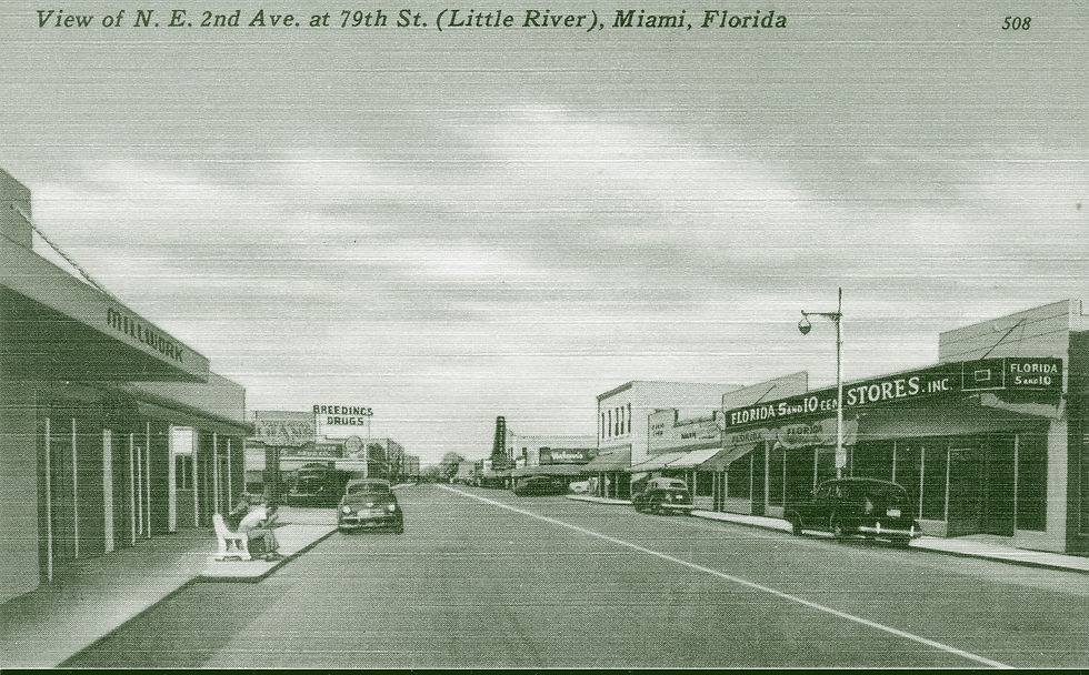
Standard gentrification and climate-driven gentrification are hard to separate in the beginning, but the researchers say the rapid gentrifying of Little River may be due to environmental and climate-related risk aversion.
Their concerns are warranted since mobile park owners are already selling plots of land for redevelopment. Because of the underlying land economics of the sale, the researchers write that it “sends a signal to other owners of low-intensity properties that it might be an optimal time to sell-out.”
And just like that, the safe and affordable mobile home neighborhoods of places like Little River are turned into refuges for the rich.
“This is most certainly the case,” the researchers write, pointing out the vulnerability of mobile home communities like Tampa’s Dixie Farms. Not only is residential capital driving Dixie Farms’s climate gentrification, but the research suggests industrial and commercial uses will intensify the exclusion.
Commercial interests are driving up the price of land, and while this type of gentrification may be climate-independent, interviews with consumers and local policy officials on the part of the researchers suggest that climate change risks from flood and inundation may have very well accelerated the process.
Making an example of Dixie Farms, the researchers say this may only increase as space for water-dependent industrial uses becomes more and more scarce.
The solutions are there, but it’s up to policymakers to enact them. With this dataset, city officials in Miami and Tampa will know how to appropriately zone affordable housing for the future, where to allocate anti-eviction resources, and where to invest public resources for property rehabilitation to ease cost-burden pressures on vulnerable communities.
According to the researchers, it also allows cities to plan long-term land use. This could look like accessible rezoning of industrial expansions in at-risk areas, focused on including local affordable housing, with mobile home parks and multi-family housing in mind.
Anticipating where environmental, economic, and social impacts may converge into a perfect storm not only helps respond to climate change but through risk management, bolsters local adaptation and mitigation efforts.
The heat, floods, hurricanes, and storms of climate change are triggering a new wave of relocation and displacement in America. While the present research focused on Florida, similar phenomena are happening in places like California, where cities face perennial risk from wildfire, and in reported “climate havens” across the Midwest and near the Great Lakes.
But, as climate change proves time and time again, no place is resistant to its impact.
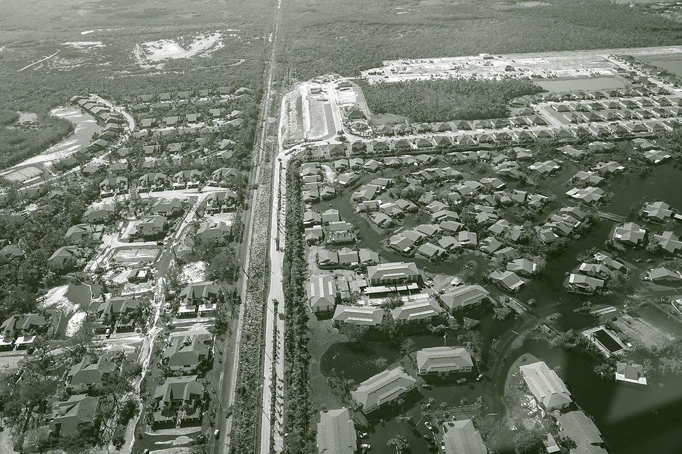
The Cape Coral-Fort Myers metro area is the sixth-largest in Florida. It's one of the fastest-growing cities in the country and sits directly between Tampa and Miami. It was also one of the areas most impacted by Hurricane Ian.
Early damage assessments suggest tens of thousands of properties will need repair, reconstruction, or complete removal, effectively reshaping the region. Communities encircling the Cape Coral-Fort Myers may soon feel the weight of migration, adversely resulting in climate gentrification.
With the index, however, city officials have the opportunity to protect existing residents from displacement and foster communities mutually beneficial for both those already there and those in need of a new home.
Comments